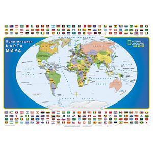
World Map for Children National Geographic
Please sign in so that we can notify you about a reply
The political map of the world of scale 1:30 000 000 (1 cm 300 km) was developed by National Geographic Maps specifically for the children"s audience. The optimal choice of cartographic projection, bright contrasting colors, a horizontal location and a large font of signatures make a card well readable, which facilitates its use by children both at school and at home. The map is framed by the flags of the world states located for the convenience of searching in alphabetical order. The dimensions of the card are 1330 x 940 mm
Cover:
Cover:Soft
Category:
- Category:History & Geography
- Category:Travel & tourism
Paper:
Paper:Coated
Series:
Series: NG card (giant)
ISBN:
ISBN:978-5-17-098372-8
No reviews found
