Political map of the world. Physical map of the world A2. In new borders.
Please sign in so that we can notify you about a reply
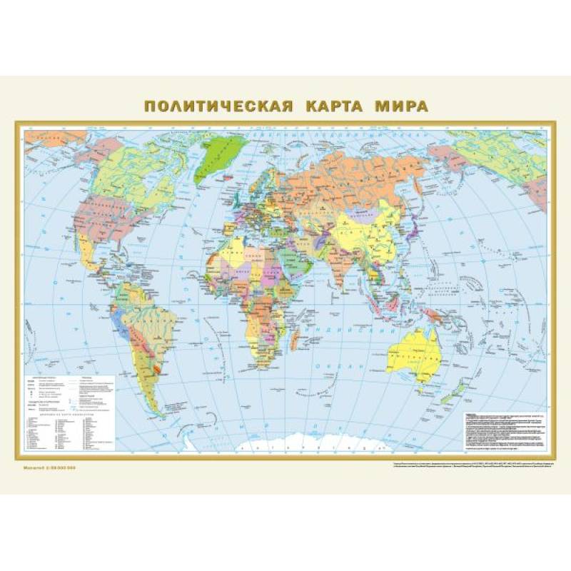
A double-sided polymer-coated map measures 575x420 mm. It consists of two maps of the same scale 1:58,000,000 (1 cm represents 580 km). The physical map of the world visually reflects the distribution of mountainous, plain, and derivative types of relief across the Earth's land surface. The highest peaks of all continents and major mountain systems are shown with elevation marks. The map includes the hydrological network, showing all major rivers with tributaries and lakes. The relief of the World Ocean floor is also presented, highlighting ridges, basins, and deep-sea trenches with their greatest depths. Warm and cold ocean currents are depicted. The updated Political map shows all independent countries of the world with their capitals, as well as territories and areas with special status. Russia is shown in its new borders: with the Donetsk and Luhansk People's Republics, Zaporizhzhia and Kherson regions, the Republic of Crimea, and Sevastopol. Populated places on the map are categorized by three population levels: over 1 million inhabitants, from 100,000 to 1 million, and less than 100,000 inhabitants. Recommended for a wide range of users.
Author:
Author:.
Cover:
Cover:softcover
Category:
- Category:History & Geography
- Category:Science & Math
Publication language:
Publication Language:Russian
Paper:
Paper:offset
Dimensions:
Dimensions:58.5x43x.2 cm
Series:
Series:Map A2
Age restrictions:
Age restrictions:0+
ISBN:
ISBN:978-5-17-154866-7
No reviews found