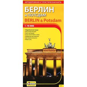
Berlin and Potsdam. Road and Tourist Map
Please sign in so that we can notify you about a reply
Scale: 1: 15000 (main card scale)
The map of the capital of Germany is included in the series of publications in the most popular Russian tourists with the cities of foreign Europe. The publication is designed both on the tourist - "pedestrian" and for those who decide to travel on a metropolis by car. The Russian edition of the Berlin map was prepared on the basis of the source materials provided by our partners from the German company Travel House Media GmbH. Berlin"s plan in the publication is presented on a large scale, allowing to cover both the historic center and the tourist and business objects have been sufficiently removed from it. At the overview maps of a smaller scale, you can get acquainted with the closest suburbs of Berlin and the main settlements and the land network of Berlin-Brandenburg. The publication is complemented by a detailed plan of the historic core of Potsdam with a park and the Palace of San Sust. A detailed and visual scheme of the high-speed railway network is also provided: S-Bahn and U-Bahn (subway), as well as road expression bus routes at airports. The reference apparatus of the publication contains indices indicators of streets marked on the Plan of Berlin, the main attractions: palaces, museums, temples, theaters, etc (in German and Russian), cultural centers and shops.
Large-scale plans indicate the names of historic districts. Not only are not only those interesting objects that are reflected in the list, but also many others, allowing more convenient to navigate in the city: markets, hospitals, educational institutions ... The most remarkable structures are displayed in the form of color three-dimensional drawings. S-Bahn and U-Bahn Lines and Stations are also applied, tram routes, railway tracks and train stations. Maps contain a lot of valuable information for motorists: transit passages are highlighted, denoted directions of one-way movement, pedestrian zones, parking spaces.
On the maps of the neighborhood of Berlin, interesting places and attractions are noted for tourists, roads with their numbers and classification and railways are shown. Additional information on the directions of outputs and not included in the coverage of the cards of interesting objects is carried out on the fields.
Maps are compiled in two languages. The main amount of information is provided in German, since without "native" titles to navigate in someone else"s city is simply impossible, but the names of settlements and all the marked attractions are also signed in Russian, taking into account their historically established writing or in transliteration.
Edition renewable, introduced the last issue. The format of the card sheet in an expanded form - 490x920 mm, folding 8 folds. Molded matte paper 115 g / m2. Format of the publication in the fairded form - 120x245 mm
Cover:
Cover:Soft
Category:
- Category:Medical Books
- Category:Travel & tourism
Paper:
Paper:Molded
Series:
Series: Maps
ISBN:
ISBN:978-5-940-59152-2
No reviews found
